We trudged up the steep trail, hoping for a reprieve from the relentless incline. The dusty dirt path was lined with tall, prickly pines and thick grasses that waved in the wind. A surprisingly warm June sun beat at our back. Our weighted footsteps and heavy breathing cut through the silence.
We were the only sound around – until a noise came from up ahead…
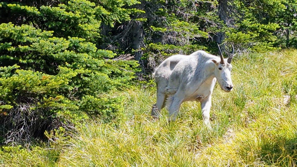
There had been recent reports of a grizzly bear in the area, so we came prepared with bear spray and my buddy, Kody, was packing a handgun with a high-caliber round. Luckily, this wild animal was not a 500-pound grizzly; it was a medium-sized mountain goat with a noticeable lazy eye. This furry fella had the ability to look at two of us at one time.
Before I divulge how this encounter played out, allow me to back up to the beginning of our trek. My wife, Trisha, and our friends, Kody and Kelsey, all wanted to hike to the tip-top of the tallest point in Bonner County, Idaho. Trisha had made it up once before, but let’s just say she didn’t enjoy herself and wanted another go at it. The rest of us had only heard of the amazing views you get at the top. But this wasn’t just a casual walk in the park. No, according to some of the AllTrails reviews, it’s a grueling hike with some intense elevation gain.
Here’s a quick list of specs to give you a taste of this place:
Scotchman Peak Specs
- Highest Peak in the Idaho Cabinet Mountain Range
- Clark Fork, Idaho (Bonner County)
- 3,717 foot elevation gain
- 7,009-foot high summit
- 7.6-mile out and back trail
- “Idaho: A Climbing Guide” dubs it the hardest Class 1 peak in Idaho
- The name originates from the peak’s resemblance to a Scotchman with a ruffled shirt
So realizing that this would require a tad more effort than a Tubbs Hill “hike” (which is a lovely, quick jaunt near Coeur d’Alene Lake), Trisha and I knew we’d need to prepare for Scotchman. To get ready for the steep hike, we hoofed it up Canfield Mountain in Coeur d’Alene one warm, windless evening about a week before our scheduled Scotchman hike. We spent a couple hours trudging up the 3,000+ foot elevation gain. After ascending the dirt (and occasionally shale-covered) trail, we enjoyed a nice snack at the mountain top. The sun began to set over the city as we descended to the base. Sunlight bathed our hometown in a warm, orange glow. It’s actually a lovely view – and not a single goat in sight. It’s not quite comparable to Scotchman, but it was enough for us to think we’d have a shot at the bigger hike.

Near the end of June, the day came to hike up the ol’ Scotchman. We all piled into our 4Runner, drove up the rough road to the base (directions here), then donned our day packs filled with water, sports drinks, and snacky stuff. AllTrails advised us to carve out at least six hours for the journey, so we made it to the trail head early. There was a chill in the air as we began our hike but the late June sun, combined with the strenuous hike, would soon have me shedding layers like a snake. I’d soon be sweating worse than the time I wore fleece pajama pants backpacking in Moab. (That’s a separate story that I’ll share one day. It’s special.)
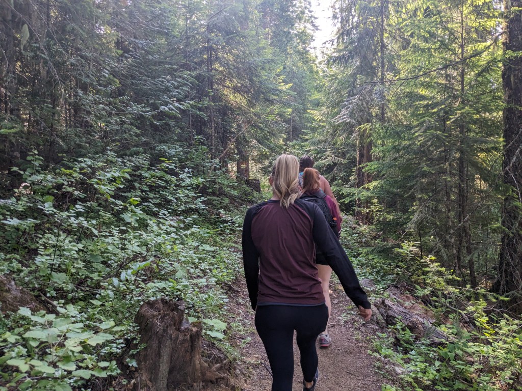
The first couple miles are relatively mild with a mixture of switchbacks and low-grade inclines that sent us up the pine-covered terrain. Our group of four stopped to breathe a bit and hydrate. But on a few occasions, someone noticed that I was mowing down on a granola bar or mixed nuts as I hiked up the monster mountain and gave me a hard time. What can I say?! I like to eat as many calories as I burn so it cancels out…
The trail began to steepen and our group spoke less to breathe more. I made an effort to talk on occasion to give any nearby bears a warning that humans were approaching, but the relentless uphill made it difficult. Kelsey and Trisha were like a couple of gazelles hoofing it uphill at a consistent pace; Kody and I stayed together a little farther back.
To break up the hike, we found a few dynamite views along the way. This gave us time to recover and re-hydrate. Plus, the trail-side lookouts gave us a taste of the ultimate panoramic view from the peak.
As we rounded a corner about three-quarters of the way up, I finally met my adversary. The lazy-eyed mountain goat I mentioned earlier on. This backcountry billy goat walked the trail like he owned it, casually nibbling at a branch here, a bush there. We moved off the path to allow the apparently oblivious creature to pass. The dude just sauntered by at his own pace. We learned later on that this furry fella had plenty of horned friends surrounding the summit, too.
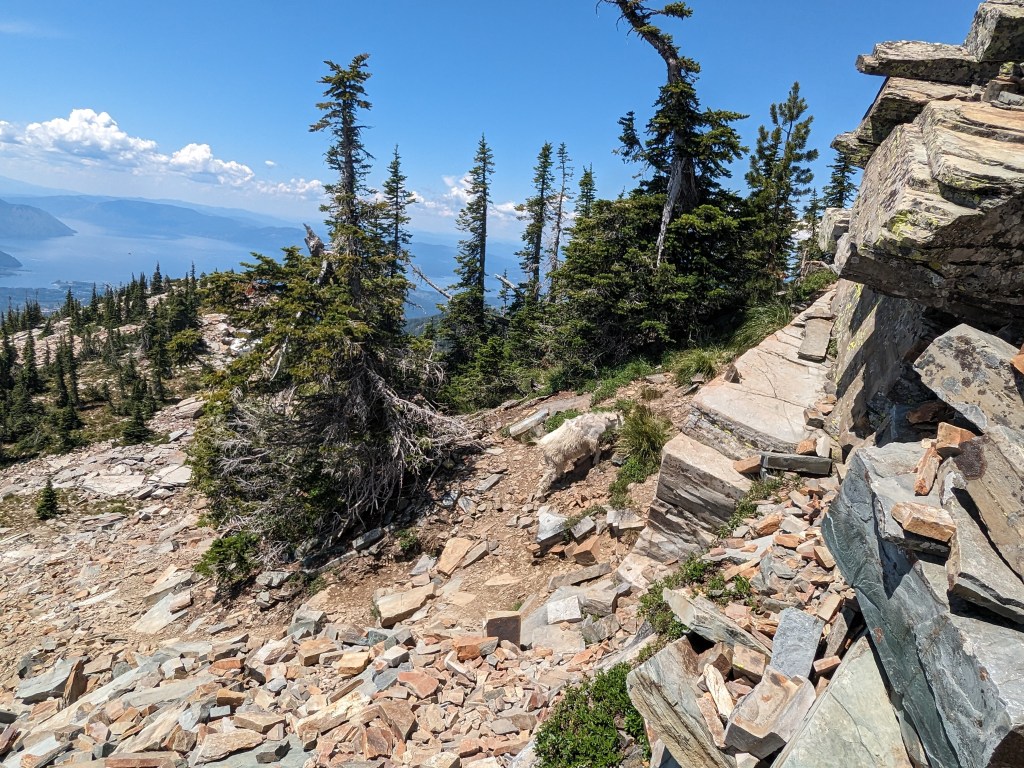
On the final push to the peak, there’s a large section that’s almost completely covered in slabs of shale. I call them ankle twisters. I’d advise wearing sturdy shoes and take extra care up this portion of “trail.”
Fun Fact: There’s a false peak that totally fooled me in this shale section. Ye be warned!

As you proceed to the actual peak, you’ll be greeted by a gaggle of goats. Gaggle? No, that’s not right. I mean a gang. A gang of goats. They’ll stare you down like you’re not welcome in their sky-high hood, so I’d suggest keeping your distance from these goat-sters.
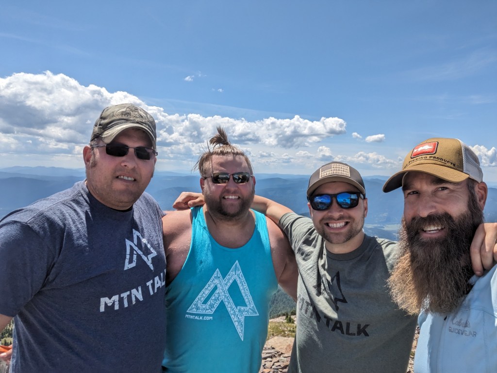
After days of hiking (OK, more like 3.5ish hours), we scrambled our way to the summit. Our party of four met our friends, Aaron and Matt, who’d started even earlier than us. We gazed out at an unbelievable view.
Scotchman Peak offers unobscured views of the pristine lakes and rivers nearby that shimmer in the sunlight. You can see parts of Idaho, Montana, and Canada from this heavenly height. “Was it worth the view,” you ask? Absolutely.

Our group spent time sitting atop the rocky peak eating our packed lunches, swapping stories, and taking in the miles of sprawling wilderness that encircled us. It was one of those moments in life that I knew I’d never forget. And, being my first big summit hike, it made me want to do more to chase that feeling of accomplishment.

The descent down was fairly uneventful. We said goodbye to the mountain goat mafia, worked out a different set of leg muscles, and made it back to our vehicles in under three hours. Some of us did, however, run out of water. I underestimated how much fluid we’d need for the journey, so I’ll definitely be packing more on any future hike of this magnitude.
I consulted our group to collect a handful of suggestions for hikers looking to take on Scotchman Peak.
Quick Tips
- Pre-hydrate – Drink before, during, and after climb time.
- Pack Snacks – Trail mix and protein bars. You know – the good stuff. I linked a list of healthy hiking food here.
- Keep It Cool – Avoid hiking in the heat of the day.
- Layer Up – The top can be cold and windy.
- Weather, Man! – With its elevation, Scotchman Peak receives snow sooner and retains it longer. Check AllTrails and local snow reports before you go.
- Take Care of Bear – Bonner County is “bear country.” Pack along easy-to-access bear spray, bells, speak loudly, hike with others, and take other precautions to stay safe from bears.
Check out the video below if you’d like to see more of the breathtaking views and gang of goats!

One thought on “MTN Talk Summits Scotchman Peak”